


 Searching...

 Previous
 Next
NextDisplaying image 302 of 467 images in History.
Not yet rated
No
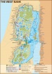
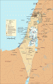
Gaza Strip 2003 - Built-up areas, refugee camps, roads, settlements, Israeli military areas and the Israeli perimeter security zone.
Map Sources:
Perry Castaneda Library "Gaza Strip, March 1999",
www.lib.utexas.edu/maps/middle_east_and_asia/gaza_strip_1999.jpg
Applied Research Institute of Jeruslaem, "Geopolitical Map of Gaza",
http://www.poica.org/maps/index.php
Palestinian Academic Society for the Study of International Affairs (PASSIA)
www.passia.org/palestine_facts/MAPS/0_pal_facts_MAPS.htm
Comments
There are no comments.
Be the first to post one.
Posting Comment...