


 Searching...

 Previous
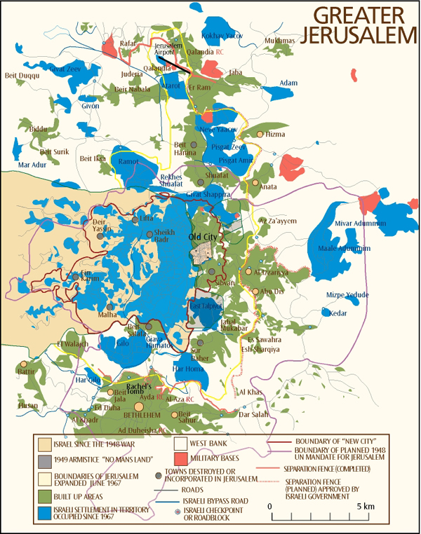
 Next
NextDisplaying image 300 of 467 images in History.
Greater Jerusalem - Built-up areas, roads, settlements, Israeli military bases, boundaries of New City, Old City and planned UN mandate for Jerusalem, checkpoints and roadblocks, Israeli bypass roads and the partly constructed separation fence.
Map Sources:
Perry - Castañeda Library, University of Texas
www.lib.utexas.edu/maps/
Palestinian Academic Society for the Study of International Affairs (PASSIA)
www.passia.org/palestine_facts/MAPS/0_pal_facts_MAPS.htm
United Nations; "Question of Palestine"
http://www.un.org/Depts/dpa/qpal/
MideastWeb
http://www.mideastweb.org/mwestb.htm
http://www.mideastweb.org/mjerusalem.htm
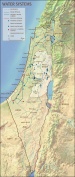
Topography
http://www.templemount.org/moriah2.html