


 Searching...

 Previous
 Next
NextDisplaying image 305 of 467 images in History.
Not yet rated
No
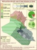
Iraq - Large Map - Roads, oil pipelines, oil fields, ancient sites, land use areas, towns, and provincial borders.
Map Sources:
UN Cartographic Section
http://www.un.org/Depts/Cartographic/english/htmain.htm
Perry-Castaneda Library, University of Texas
http://www.lib.utexas.edu/maps/middle_east_and_asia/iraq_oil...
http://www.lib.utexas.edu/maps/atlas_middle_east/iraq_land.j...
National Geographic Society, Heart of the Middle East, (Supplement to National Geographic, October 2002).
Comments
There are no comments.
Be the first to post one.
Posting Comment...