


 Searching...

 Previous
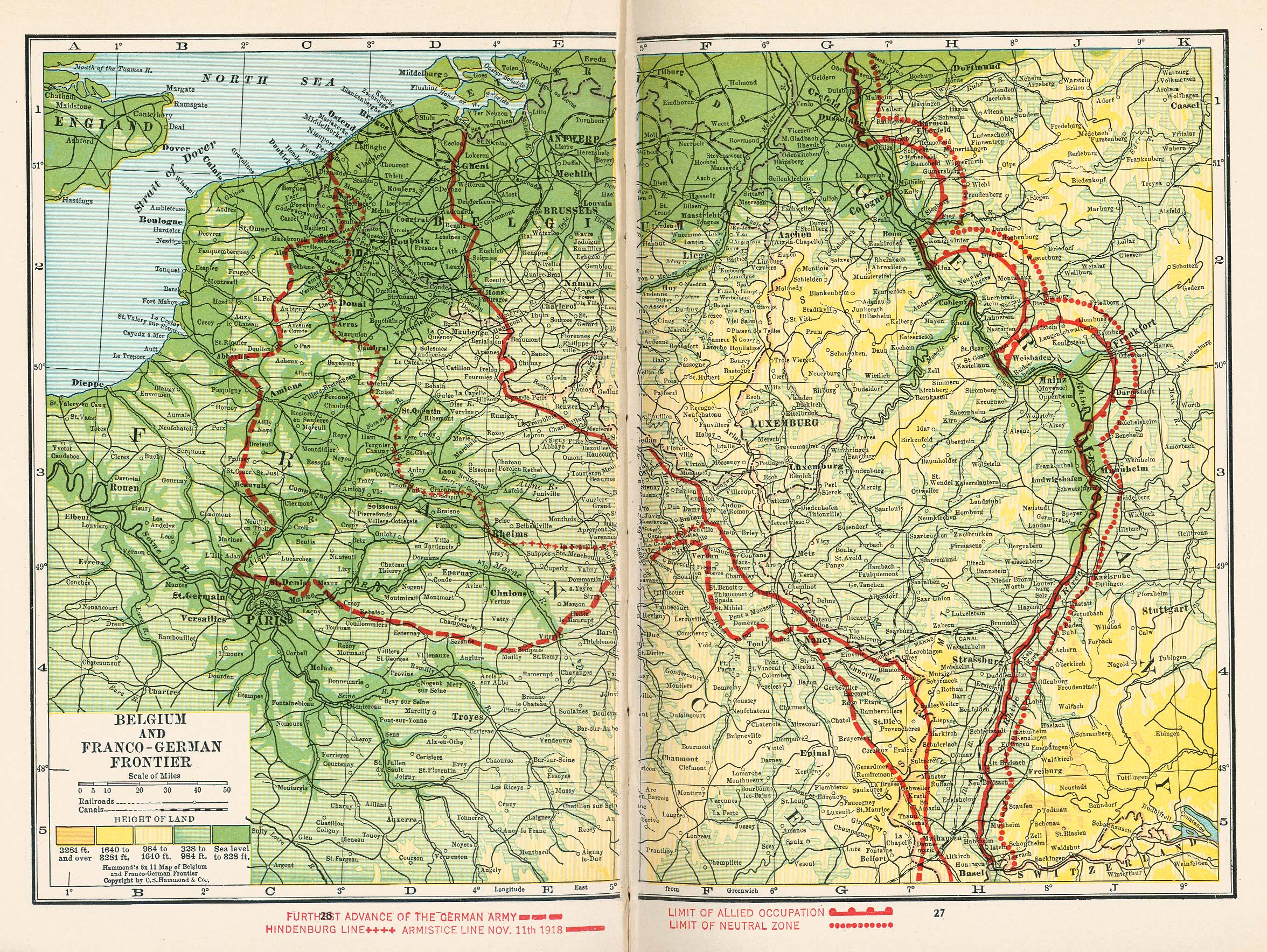
 Next
NextDisplaying image 123 of 467 images in History.
Not yet rated
No
From Putnam's Handy Volume Atlas of the World. Published by G.P. Putnam's Sons, New York and London, 1921.
Source: University of Texas at Austin, Perry-Castaneda Library, Map Collection
http://www.lib.utexas.edu/maps/
Comments
There are no comments.
Be the first to post one.
Posting Comment...